Inca Trail · Site 2 of 11
Patallacta
The valley that fed the journey
Also labeled Llactapata or Patallaqta
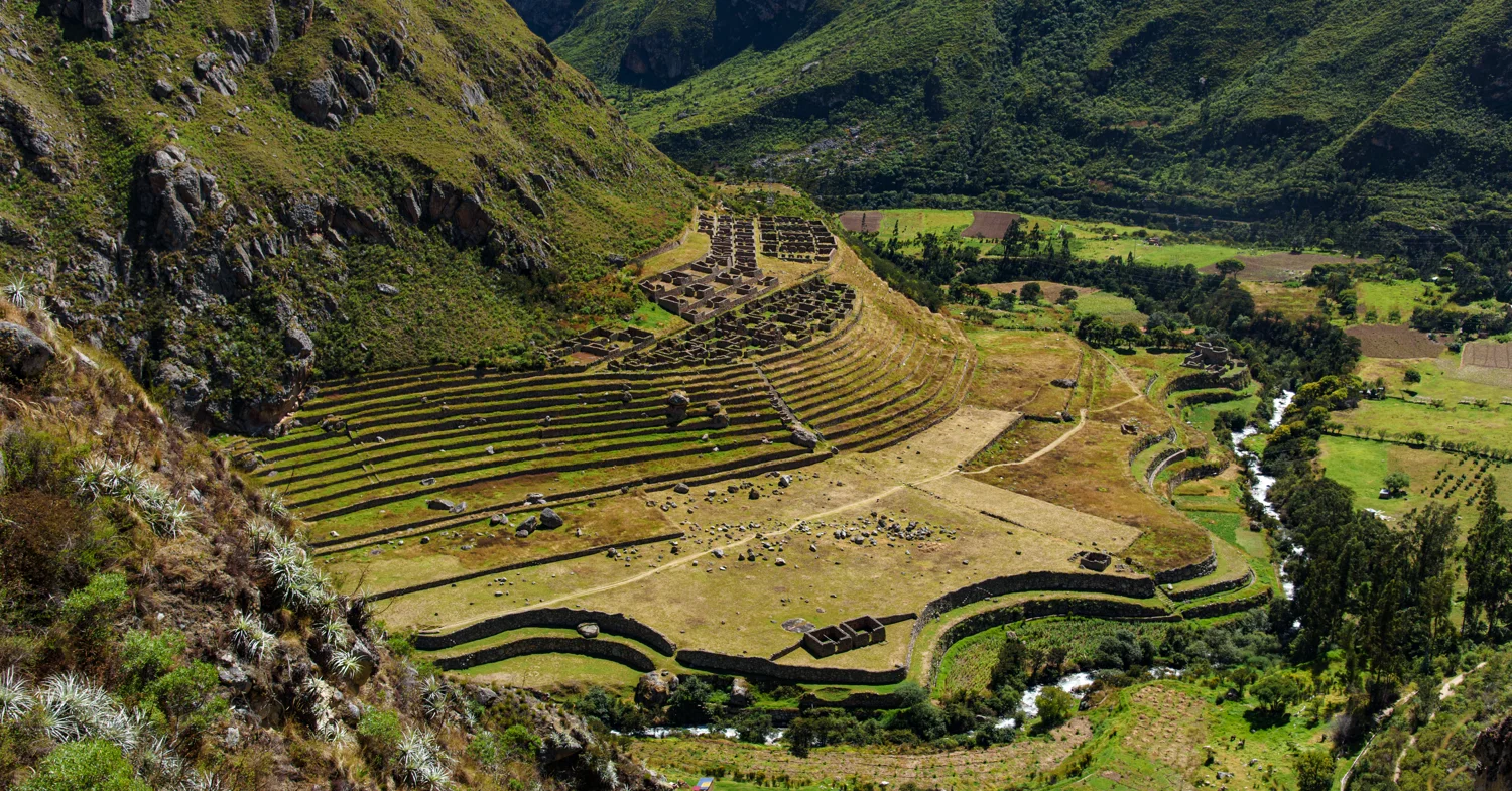
Before the trail climbs into cloud forest, Patallacta reveals a different scale of Inca building: long agricultural terraces, a compact settlement, and a valley floor shaped by water. From above, its plan is unusually easy to read.
Understanding the site
Patallacta stands near the meeting of the Cusichaca and Vilcanota rivers. Its terraces and buildings belong to the inhabited, cultivated landscape at the beginning of the classic Inca Trail. The name Llactapata is often used for this site, but it is also used for a different ruin west of Machu Picchu on the Salkantay side. Those two places should not be confused.
A settlement and its working landscape
Peru’s official tourism inventory recognizes both agricultural terraces and ceremonial enclosures at Llactapata. That combination matters: this was more than a spectacular field of terraces. Thinking about residence, cultivated ground and ceremonial space together helps turn the distant view into a settlement with different activities. The label agricultural center should not erase the other parts of the place. [3]
Why this site is special
The broad view allows you to consider architecture at the scale of a valley. Trace the terrace edges toward the clusters of buildings and compare their different shapes. Where a close-up emphasizes masonry, this view raises questions about connections: how people moved, where built spaces met cultivated ground, and how a settlement occupied a slope. It is a useful contrast to the compact, constrained layouts at Sayacmarca and Conchamarca. Archaeological interpretation starts with those relationships, not simply the number of walls.
Reading the landscape
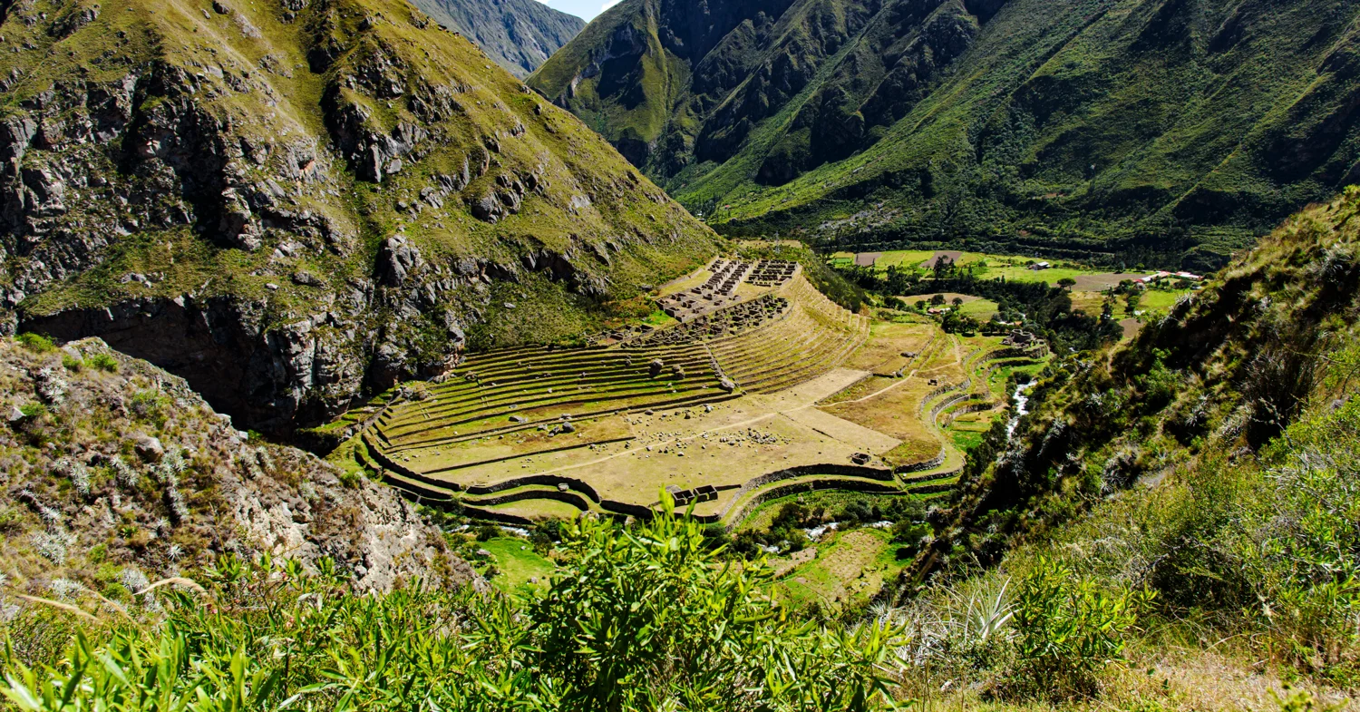
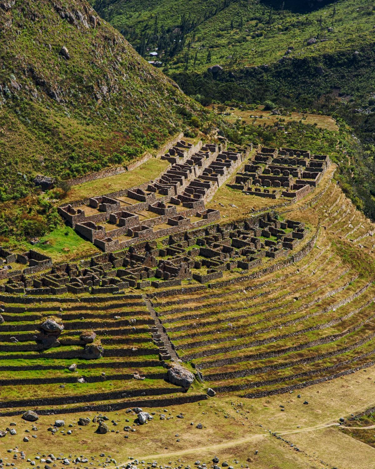
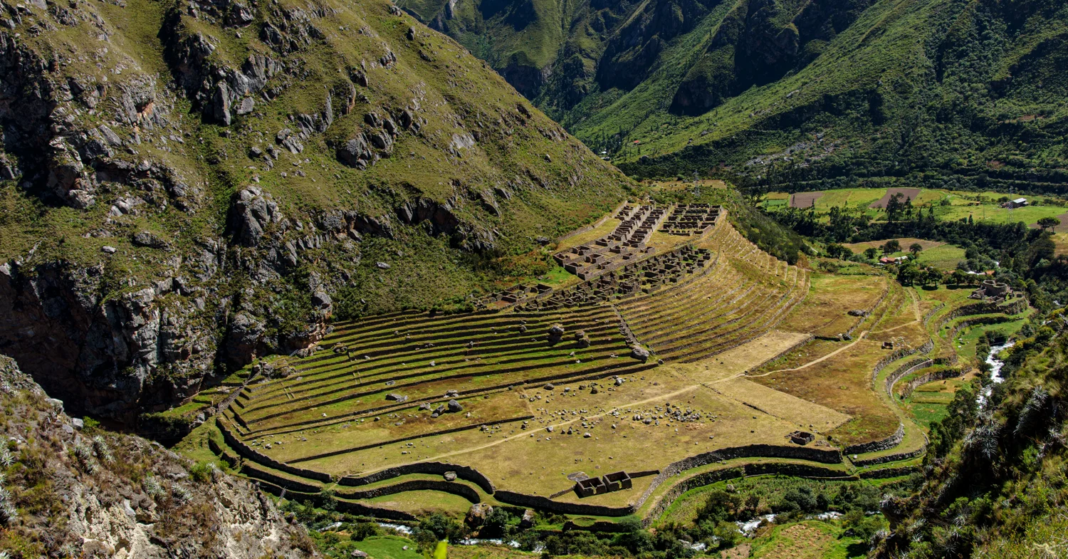
In these photographs, the broad curves at the foot of the slope give way to tighter rows near the buildings. Look at how much land is organized around the settlement, rather than looking only for a single impressive wall. The valley view makes the relationship between habitation, agriculture and terrain visible in one frame.
Look more closely
- Trace the curved lower terraces against the straighter rows above.
- Find the small rectangular rooms at the upper edge of the cultivated area.
- Compare the wide view with the closer terrace studies to understand scale.
How does the valley setting change your impression of a route usually associated with high mountain passes?
Patallacta in photographs
My photographs from this site. Select an image to see the full frame.
View all 8 photographs
Photograph by Brandon Wichmann
Photograph by Brandon Wichmann
Photograph by Brandon Wichmann
Photograph by Brandon Wichmann
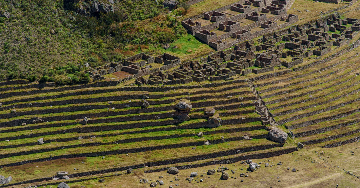
Photograph by Brandon Wichmann
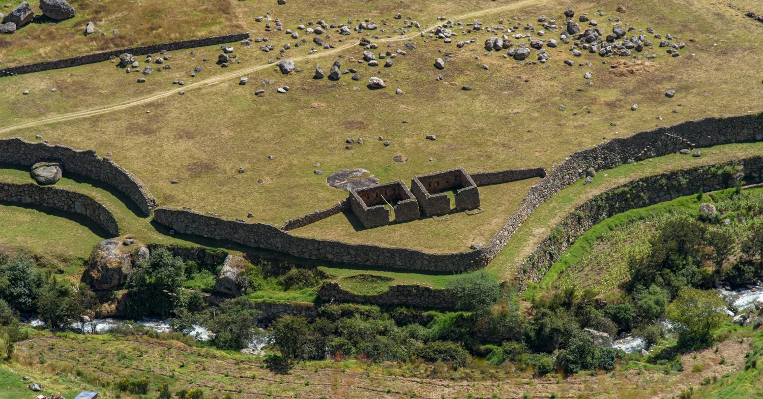
Photograph by Brandon Wichmann
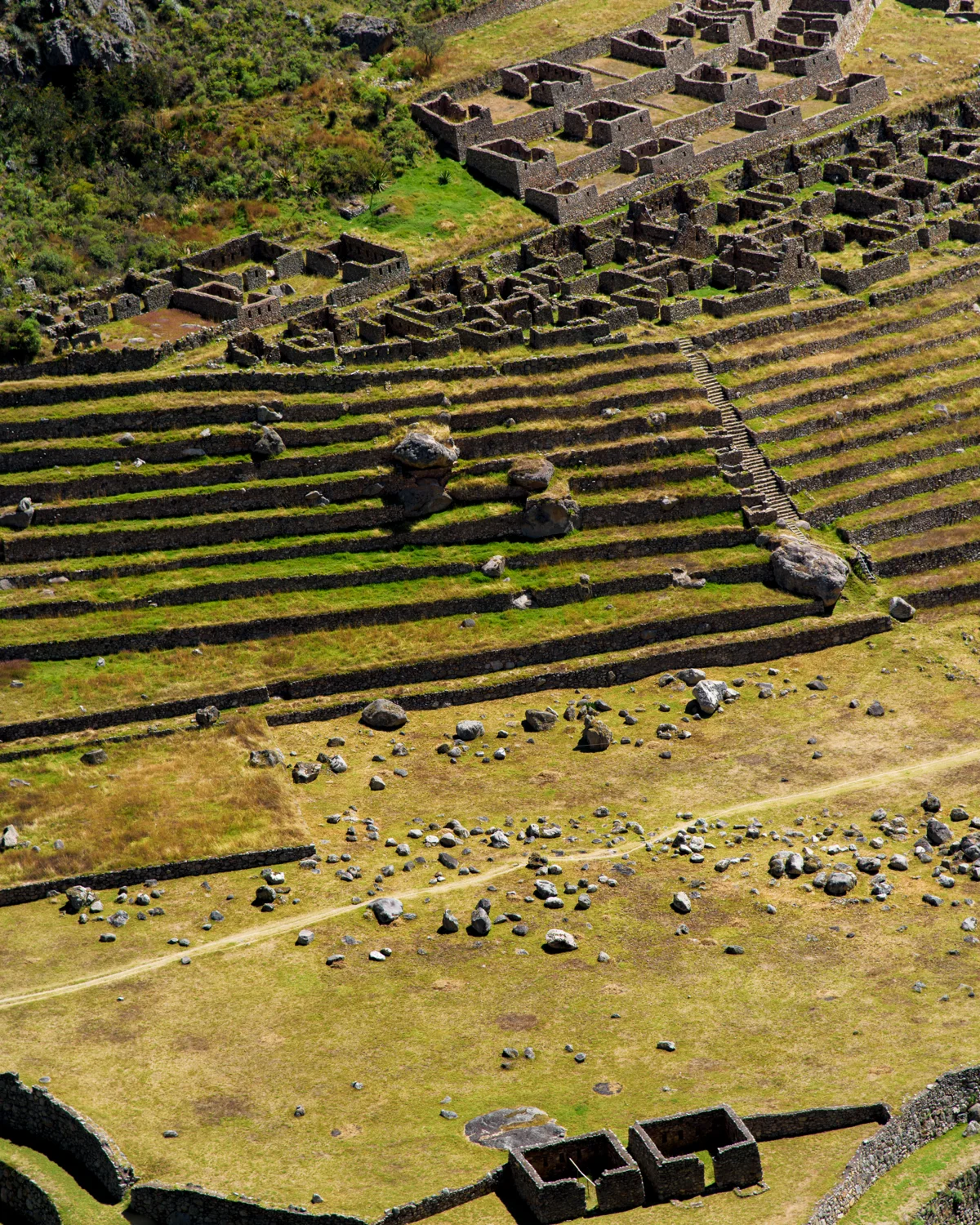
Photograph by Brandon Wichmann
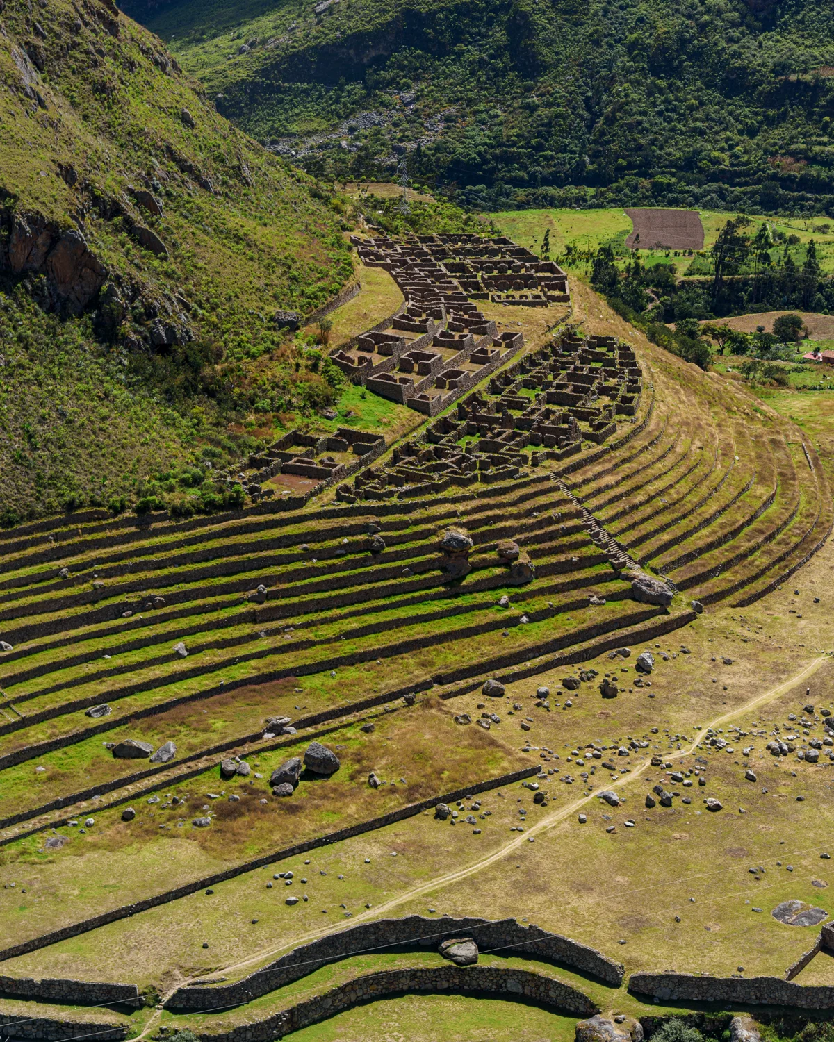
Photograph by Brandon Wichmann
Sources & further reading
Historical context is drawn from the sources below. Observations about the photographs and personal recollections are my own.